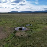
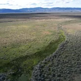
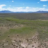
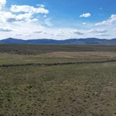
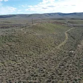
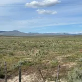
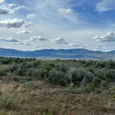

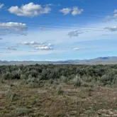


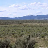
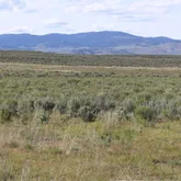
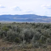
Description
- Listed by Janey Knipe • Knipe Land Company
Property Details for Tbd Tbd John Day Highway
Property Details for Tbd Tbd John Day Highway
| Status | Active |
|---|---|
| MLS # | 98954132 |
| Days on Market | 50 |
| Taxes | $246 / year |
| HOA Fees | - |
| Condo/Co-op Fees | - |
| Compass Type | Land |
| MLS Type | Land / Unimproved Land |
| Year Built | - |
| Lot Size | 1490.20 AC |
| County | Malheur County |
Location
Building Information for Tbd Tbd John Day Highway
Payment Calculator
$5,950 per month
30 year fixed, 6.28% Interest
$5,930
$21
$0
Property Information for Tbd Tbd John Day Highway
- Zoning Description: C-A2
- Tax Legal Description: Lengthy - call listing agent
- Tax Year: 2024
- Additional Parcels Description: 2800 2400
- Additional Parcels: Yes
- Parcel Number: 4200
- Elementary School: Burnt River
- Elementary School District: Burnt River School District
- HighSchool: Burnt River
- HighSchool District: Burnt River School District
- Middle Or Junior School: Burnt River
- Middle Or Junior School District: Burnt River School District
- RoadSurfaceType: Paved
- Above Grade Finished Area Units: Square Feet
- Below Grade Finished Area Units: Square Feet
- Building Area Units: Square Feet
- Elevation: 3760
- Farm Land Area Units: Square Feet
- Living Area Units: Square Feet
- Lot Features: Over 40 Acres, Rolling Slope, Solar Potential, Views
- Lot Size Acres: 1490.2
- Lot Size Area: 1490.2
- Lot Size Square Feet: 6.4913112E7
- Lot Size Units: Acres
- Photos Count: 15
- Utilities: Electricity Available, Natural Gas Not Available, Phone Connected, Electricity Connected, Overhead
- Water Source: Spring
- Fencing: Partial, Wire
- Electric On Property: Yes
Property History for Tbd Tbd John Day Highway
| Date | Event & Source | Price | Appreciation |
|---|---|---|---|
| Jul 10, 2025 | Listed (Active) IMLS #98954132 | $1,200,000 | — |
| Date | Event & Source | Price |
|---|---|---|
| 07/10/2025 | Listed (Active) IMLS #98954132 | $1,200,000 |
For completeness, Compass often displays two records for one sale: the MLS record and the public record.
Schools near Tbd Tbd John Day Highway
Rating | School | Type | Grades | Distance |
|---|---|---|---|---|
| Charter - | K to 12 |
Rating | School | Distance |
|---|---|---|
Burnt River School CharterK to 12 |
School ratings and boundaries are provided by GreatSchools.org and Pitney Bowes. This information should only be used as a reference. Proximity or boundaries shown here are not a guarantee of enrollment. Please reach out to schools directly to verify all information and enrollment eligibility.
Similar Homes
Similar Sold Homes
Explore Nearby Homes
- Greenhorn Homes for Sale
- Granite Homes for Sale
- Annex Homes for Sale
- Island City Homes for Sale
- Wallowa Lake Homes for Sale
- Karcher Homes for Sale
- Treasure Valley Homes for Sale
- Cortland Place Homes for Sale
- North Nampa Homes for Sale
- Downtown Nampa Homes for Sale
- Old Nampa Homes for Sale
- Griffith Kings Homes for Sale
- University District Homes for Sale
- Airport District Homes for Sale
- Northeast Nampa Homes for Sale
- Bridgeport Homes for Sale
- Drewsey Homes for Sale
- Durkee Homes for Sale
- Ironside Homes for Sale
- Unity Homes for Sale
- Hereford Homes for Sale
- Brogan Homes for Sale
- Jamieson Homes for Sale
- Westfall Homes for Sale
- Harper Homes for Sale
- Juntura Homes for Sale
- Huntington Homes for Sale
- Baker City Homes for Sale
- Sumpter Homes for Sale
- Riverside Homes for Sale
- 97819 Homes for Sale
- 97837 Homes for Sale
- 97884 Homes for Sale
- 97903 Homes for Sale
- 97904 Homes for Sale
- 97911 Homes for Sale
- 97920 Homes for Sale
- 97907 Homes for Sale
- 97869 Homes for Sale
- 97814 Homes for Sale
- 97905 Homes for Sale
- 97909 Homes for Sale
- 97918 Homes for Sale
- 97906 Homes for Sale
- 97914 Homes for Sale
No guarantee, warranty or representation of any kind is made regarding the completeness or accuracy of descriptions or measurements (including square footage measurements and property condition), such should be independently verified, and Compass expressly disclaims any liability in connection therewith. Photos may be virtually staged or digitally enhanced and may not reflect actual property conditions. Offers of compensation are subject to change at the discretion of the seller. No financial or legal advice provided. Equal Housing Opportunity.
Listing Courtesy of Knipe Land Company
All information provided is deemed reliable but is not guaranteed and should be independently verified. The content relating to real estate for sale on this web site comes in part from the IDX program of the RMLS of Portland Oregon. Real estate listings held by brokerage firms other than Compass are marked with the RMLS logo and detailed information about these properties includes the names of the listing brokers. Copyright © 2025 RMLS, Portland, Oregon. Last updated: 07/13/2025 12:06 AM