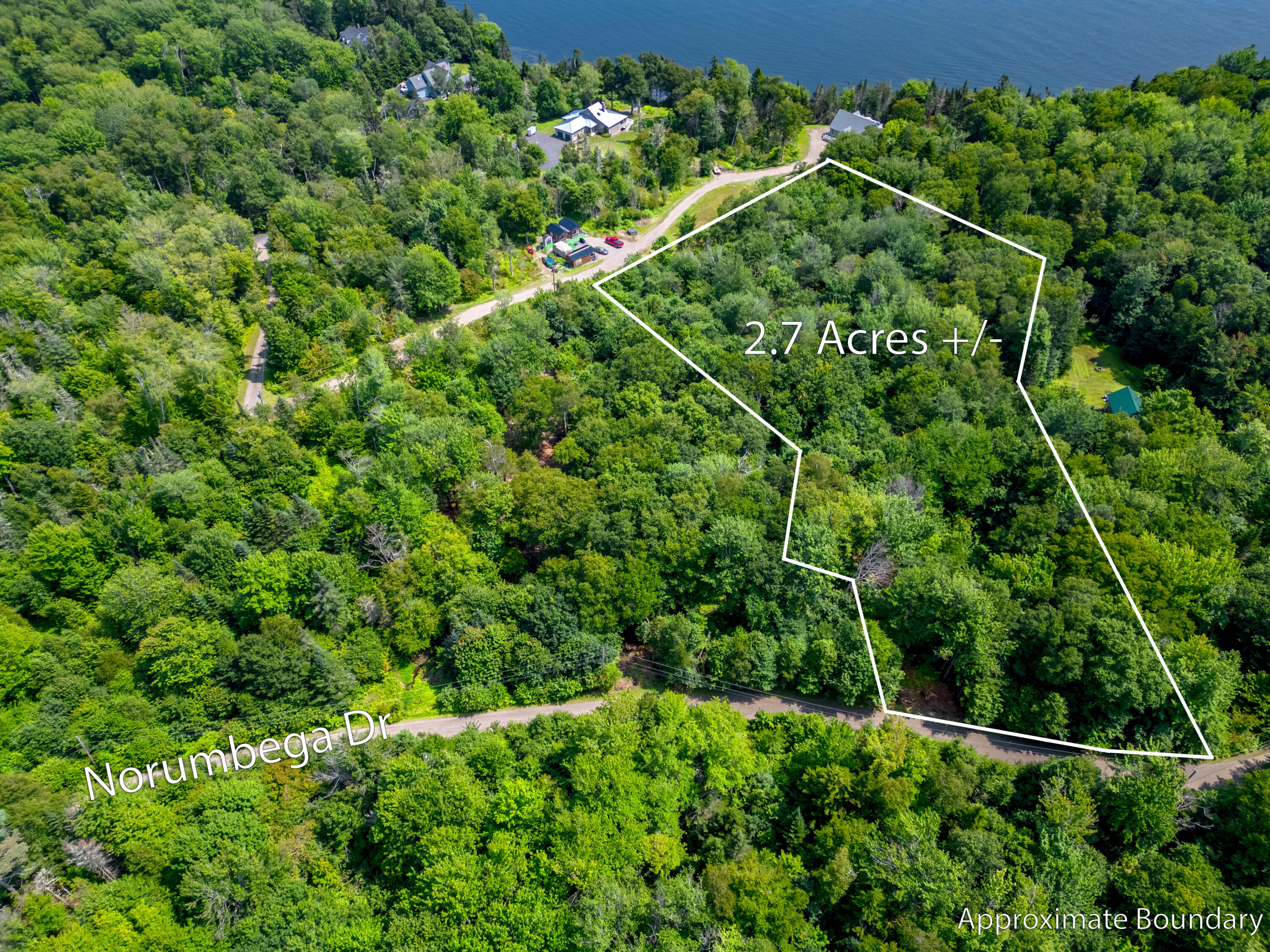
28 Norumbega Drive
28 Norumbega Drive


Description
Property Details for 28 Norumbega Drive
Location
Property Details for 28 Norumbega Drive
| Status | Active |
|---|---|
| MLS # | 1565499 |
| Days on Market | 314 |
| Taxes | $532 / year |
| HOA Fees | $1 / year |
| Condo/Co-op Fees | - |
| Compass Type | Land |
| MLS Type | Land |
| Year Built | - |
| Lot Size | 2.77 AC |
| County | Waldo County |
Location
Building Information for 28 Norumbega Drive
Payment Calculator
$480 per month
30 year fixed, 7.25% Interest
$436
$44
$0
Property Information for 28 Norumbega Drive
- Road Surface Type: Gravel
- Water Body Name: Penobscot River
- Directions: From Route 1 in Stockton Springs, turn on Main Street. Turn on Cape Jellison Road towards Fort Point State Park (Lighthouse Road). Turn on Norumbega Drive. Look for signs on the left.
- Town: Stockton Springs
- State/Province: ME
- Zip Code: 04981
- County: Waldo
- Geo Latitude: 44.462337
- Geo Longitude: -68.831775
- Road Frontage Type: Private
- Tax Lot: 076C-5
- Site:Open: Yes
- Site:Right of Way: Yes
- Site:Rolling/Sloping: Yes
- Site:Wooded: Yes
- Location:Near Public Beach: Yes
- Location:Near Shopping: Yes
- Location:Near Town: Yes
- Location:Subdivision: Yes
- Transportation:Near Airport: Yes
- Water Info:Waterfront Amount +: 6.00
- Water Info:Water Frontage Owned: .00
- Water Info:Water Frontage Shared: 6.00
- Source of Water Frontage:Seller: Yes
- Source of Water Frontage:Survey: Yes
- Recreational Water:Deeded: Yes
- Recreational Water:Nearby: Yes
- Recreational Water:River/Brook/Stream: Yes
- Recreational Water:ROW to Water: Yes
- Parking Features: No Driveway, On Site, Off Street
- Tax Book Number: 3423
- Tax Map Number: R5
- Tax Year: 2022
- Parcel Number: STOS-000005R-000000-000076C-000004
- Location Information:Association Y/N: Yes
- Tax Annual Amount: $532.00
- School District: RSU 20
- Lot Size Acres: 2.77
- Source of Acreage: Public Records
- Lot Size Area: 2.77
- Lot Size Units: Acres
- Lot Size Square Feet: 120661.2
- Street Number: 28
- Property Information:Surveyed: Yes
- Property Information:Seasonal: No
- Property Information:Deed Type Offered: Warranty
- Property Information:Deed: All
- Property Information:Deed Restrictions: Yes
- Property Information:Mobile Homes Allowed: No
- Property Information:Source of Road Frontage: Survey
- Driveway:No Driveway: Yes
- Sign on Property: Yes
- Documents Available: Property Disclosure Public Access
- Property Type: Land
- Property Type Label: Land
- Electric: Other Electric
- Sewer: Private Sewer, Septic Needed
- Water Source: Private, Well Needed on Site
- Gas:No Gas: Yes
- Bathrooms Total (Integer): 0
- Bathrooms Total (Decimal): .00
- Bathrooms Total (Notational): .00
Property History for 28 Norumbega Drive
| Date | Event & Source | Price | Appreciation |
|---|
| Date | Event & Source | Price |
|---|
For completeness, Compass often displays two records for one sale: the MLS record and the public record.
Public Records for 28 Norumbega Drive
Schools near 28 Norumbega Drive
Rating | School | Type | Grades | Distance |
|---|---|---|---|---|
| Public - | PK to 5 | |||
| Public - | 6 to 8 | |||
| Public - | 9 to 12 |
Rating | School | Distance |
|---|---|---|
Searsport Elementary School PublicPK to 5 | ||
Searsport District Middle School Public6 to 8 | ||
Searsport District High School Public9 to 12 |
School ratings and boundaries are provided by GreatSchools.org and Pitney Bowes. This information should only be used as a reference. Proximity or boundaries shown here are not a guarantee of enrollment. Please reach out to schools directly to verify all information and enrollment eligibility.
Similar Homes
Similar Sold Homes
Homes for Sale near Stockton Springs
Neighborhoods
Cities
No guarantee, warranty or representation of any kind is made regarding the completeness or accuracy of descriptions or measurements (including square footage measurements and property condition), such should be independently verified, and Compass expressly disclaims any liability in connection therewith. Photos may be virtually staged or digitally enhanced and may not reflect actual property conditions. No financial or legal advice provided. Equal Housing Opportunity. Subject to change at any time. Compass makes no guarantee, warranty or representation regarding the accuracy of any waterfront feature, water view or waterfront view.
Listing Courtesy of Gregory W. Peet Real Estate
Listing data is derived in whole or in part from the Maine IDX and is for consumers' personal, noncommercial use only. Dimensions are approximate and not guaranteed. All data should be independently verified. © 2022 Maine Real Estate Information System, Inc. All Rights Reserved.


