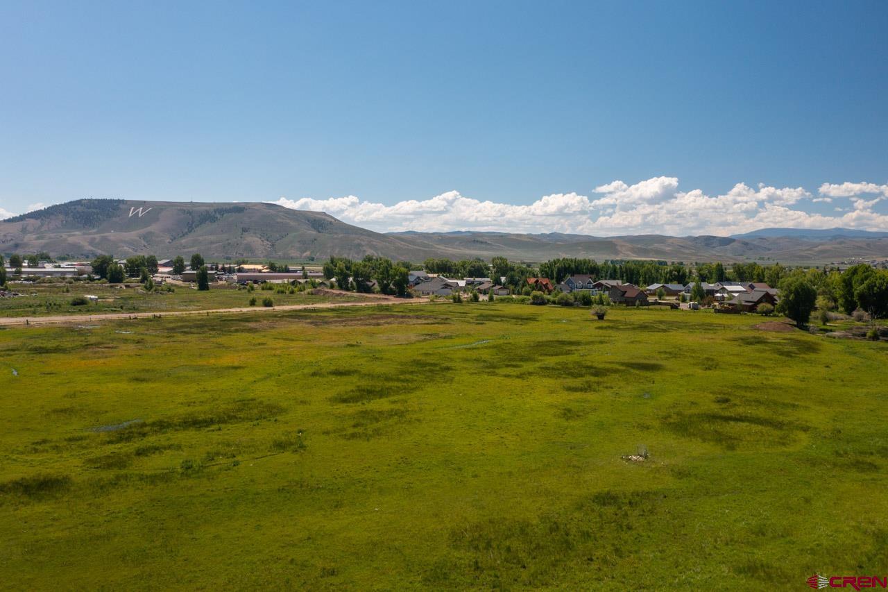
Tbd West Gunnison Avenue
Tbd West Gunnison Avenue


Description
- Listed by Channing Boucher • LIV Sotheby's International Realty - CB
Property Details for Tbd West Gunnison Avenue
Location
Property Details for Tbd West Gunnison Avenue
| Status | Active |
|---|---|
| MLS # | 805483 |
| Days on Market | 299 |
| Taxes | $153 / year |
| HOA Fees | - |
| Condo/Co-op Fees | - |
| Compass Type | Land |
| MLS Type | LAND / Agricultural |
| Year Built | - |
| Lot Size | 25.00 AC |
| County | Gunnison County |
Location
Building Information for Tbd West Gunnison Avenue
Payment Calculator
$49,129 per month
30 year fixed, 7.25% Interest
$49,117
$13
$0
Property Information for Tbd West Gunnison Avenue
- Directions: Highway 50 to West New York Avenue. Go west to South Fifth then West Gunnison Avenue. Land is south of West Gunnison Avenue and north of Thorton Way.
- Access: Year Round
- Owner Name: Sherman Street Holdings
- Elementary School: Gunnison 1-5
- Middle School: Gunnison 6-8
- High School: Gunnison 9-12
- HOA Y/N: No
- Other Transfer Fees Y/N: No
- Tax Year: 2022
- Total Taxes $: 153
- FIPS Code: 08051
- Legal/Lot Block: 25 ACRES IN SECTION 2, TOWNSHIP 49N, RANGE 1W
- Photo Count: 30
- Press System Y/N: No
- Adjudicated Y/N: Yes
- Covenants Y/N: NO
- Board Name: Gunnison-Crested Butte Association of REALTORS
- Acres Source: assessor
- Livestock Allowed: Cattle
- Income Producing: No
- Special Assemnt Y/N: No
- Water Rights/Irrigation: Yes
- Lot Size/Acerage: 21-35 Acres
- Current Property Use: Ag/Livestock
- Possible Property Use: Residential Single Family
- Parcel ID #: 3.7870220001E11
- Elevation: 7700
- Irrigation/Water District: SLO
- Sewer Tap Avail: Yes
- Sewer/Septic In: No
- Sewer Paid: No
- Water Tap Avail: Yes
- Water Tap Installed: No
- Water Tap Paid: No
- Mineral Rights: Unknown
- Modular/Mobile Allow: Both
- Water Well: No
- 1/2 Baths: 0
- 3/4 Baths: 0
- 1/4 Baths: 0
- Horse Setup: No
- Fence: Smooth Wire
- Topography: Level
Property History for Tbd West Gunnison Avenue
| Date | Event & Source | Price | Appreciation |
|---|
| Date | Event & Source | Price |
|---|
For completeness, Compass often displays two records for one sale: the MLS record and the public record.
Schools near Tbd West Gunnison Avenue
Rating | School | Type | Grades | Distance |
|---|---|---|---|---|
| Public - | PK to 5 | |||
| Charter - | K to 10 | |||
| Public - | 6 to 8 | |||
| Public - | 6 to 12 |
Rating | School | Distance |
|---|---|---|
Gunnison Elementary School PublicPK to 5 | ||
Marble Charter School CharterK to 10 | ||
Gunnison Middle School Public6 to 8 | ||
Crested Butte Community School Public6 to 12 |
School ratings and boundaries are provided by GreatSchools.org and Pitney Bowes. This information should only be used as a reference. Proximity or boundaries shown here are not a guarantee of enrollment. Please reach out to schools directly to verify all information and enrollment eligibility.
Similar Homes
Similar Sold Homes
Homes for Sale near Gunnison
Neighborhoods
Cities
No guarantee, warranty or representation of any kind is made regarding the completeness or accuracy of descriptions or measurements (including square footage measurements and property condition), such should be independently verified, and Compass expressly disclaims any liability in connection therewith. Photos may be virtually staged or digitally enhanced and may not reflect actual property conditions. No financial or legal advice provided. Equal Housing Opportunity.
Listing Courtesy of LIV Sotheby's International Realty - CB, Channing Boucher
All information is deemed reliable, but accuracy is not guaranteed. Listing information is based on information from the Aspen / Glenwood MLS for the period 07/04/2023 06:00 PM through 04/29/2024 06:08 PM. The property information being provided is for the consumer’s personal non-commercial use and may not be used for any purpose other than to identify prospective properties consumers may be interested in purchasing. Data last updated on 07/08/2023 01:38 AM


